Services

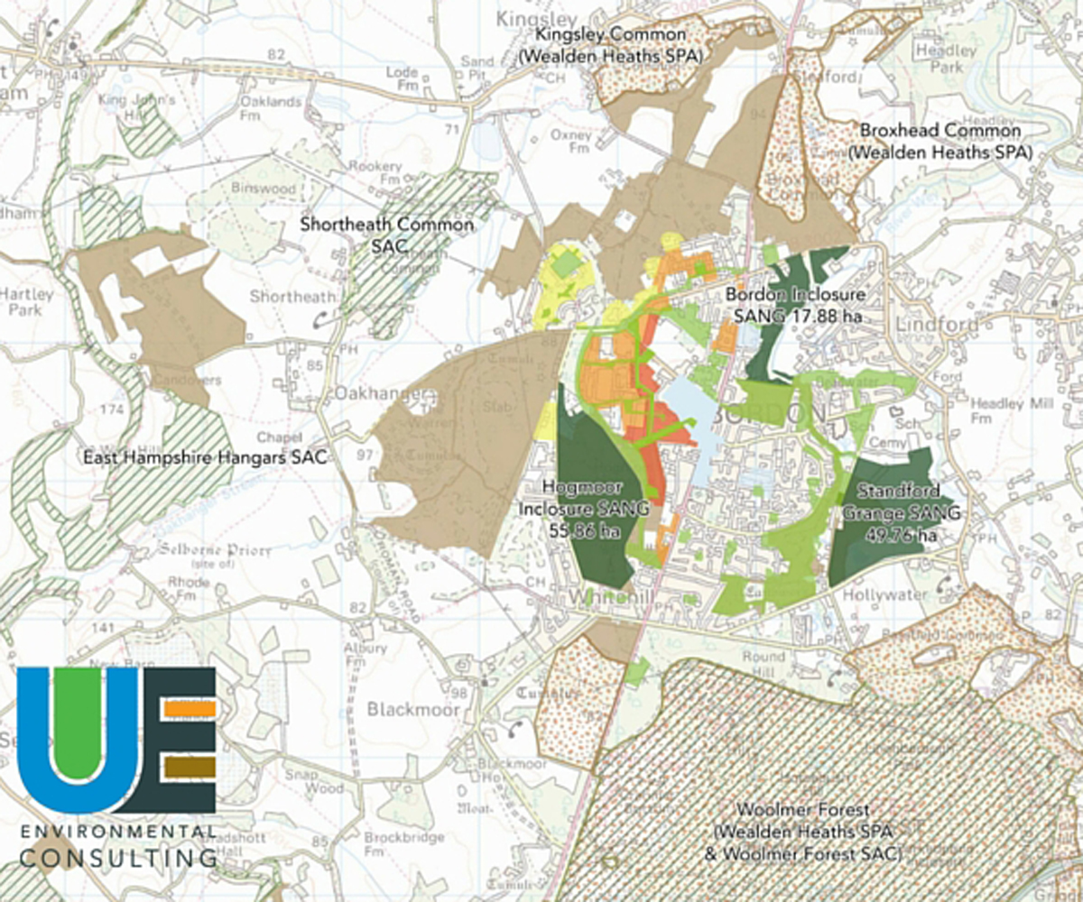
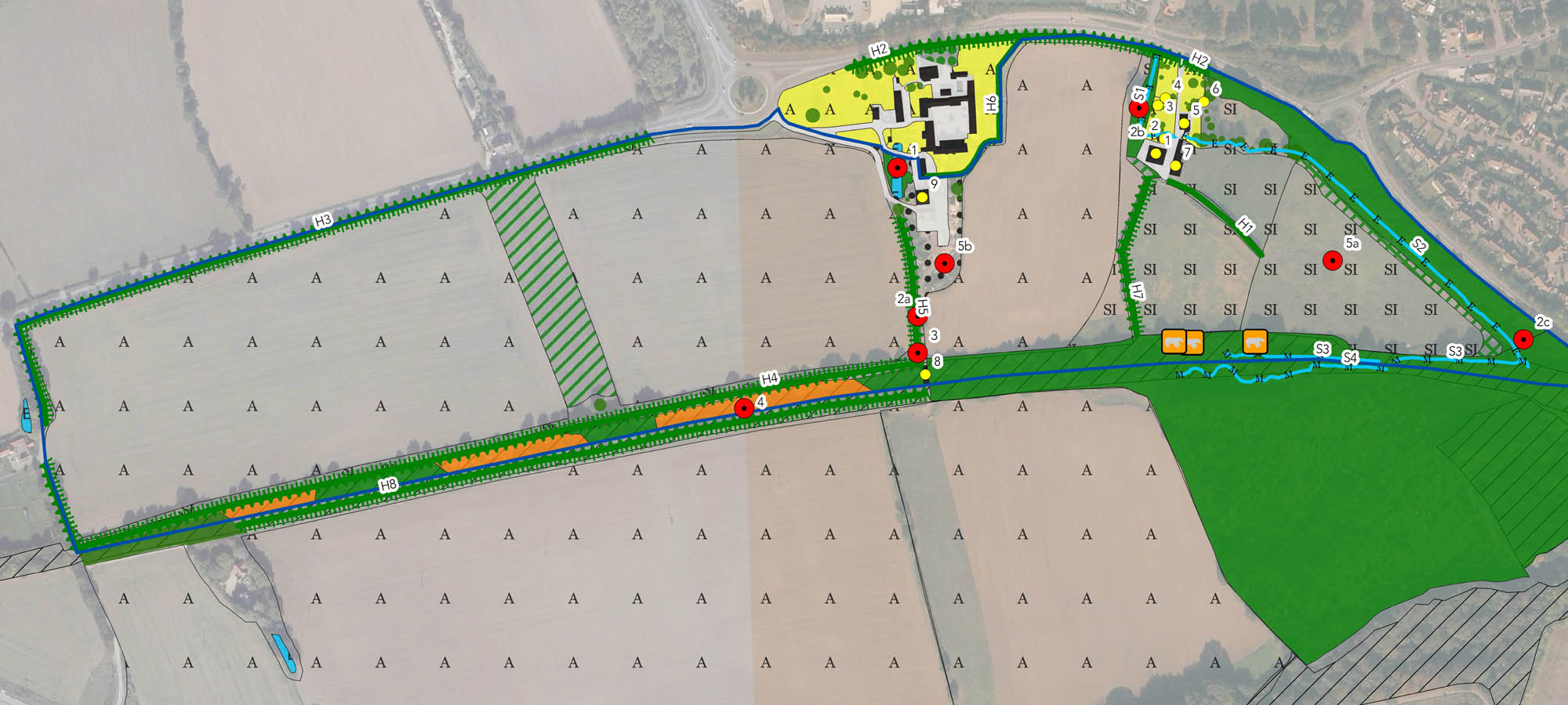
Geographic Information Systems

A Geographic Information System (GIS) is used to capture, manage, analyse, display and query all forms of geographically reference. GIS allows us to visualise the world in ways that reveal relationships, patterns, and trends in the form of maps, models, reports, and charts. GIS software helps us answer questions, solve problems and convey large amounts of information in a way that is quickly understood and easily shared. Urban Edge Environmental Consulting uses GIS in the majority of our projects in order to better understand the potential effects of plans, strategies and projects on the human and natural environment. GIS analysis and maps help inform our work, as well as being essential for our clients and stakeholders – as the saying goes, ‘a picture tells a thousand words’. Our GIS projects have included the collection and representation of data across the whole of Scotland, for sub-regions such as the Black Country and South Hampshire, for individual cities, districts and boroughs, and for localised projects and site-specific zones of influence in Environmental/Ecological Impact Assessments.

  • Our Clients

    We commissioned Urban Edge Environmental to carry out an HRA for the Eco-town project, supported by visitor surveys and green infrastructure planning to address possible impacts. Their team is committed to the profession, which was demonstrated in the high quality of work. Able to deal with a range of stakeholders with diverse views and filter out the key issues. Got to grips with the requirements quickly and understood the project’s wider sensitivities and interdependencies. The reporting style was consistent, balanced and well received by stakeholders and the client team.

    Bruce Collinson, Environmental Sustainability Lead, Whitehill Bordon Eco-town
    See More

We regularly create entire suites of maps for local authorities on a variety of topics as part of Green Infrastructure Strategies, Sustainability Appraisals and Strategic Environmental Assessments. In previous projects we have mapped environmental constraints, accessibility, flood zones, population and deprivation characteristics, health services, wildlife corridors, open space, proposed developments and transport links, and catchment zones for recreational sites. For research projects, we have digitised and analysed post code, origin, destination, species territory, and route data for a variety of spatial analyses. GIS has been instrumental in the assessment of our recreational and visitor surveys, and for creating detailed surface maps of air pollution levels around the Solent. We also use GIS to identify which protected environments may potentially be affected by proposals in development plans (e.g. as part of Environmental Impact Assessments or Habitats Regulations Assessments), as well as for mapping habitat types, target notes and territories in ecological surveys.

Ecological Surveys

Impact Assessments

Environmental Planning

Arboriculture

Biodiversity Net Gain